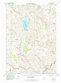
1966 Map of Beulah
USGS Topo · Published 1984About this map
The North Fork Malheur River is the central artery of this high-desert landscape, flowing through a region dominated by the Beulah Reservoir and the Agency Valley Dam. This 1966 field-checked survey captures the area around the settlement of Beulah, a focal point for water management in Malheur County. The map provides clear evidence of the region's volcanic and geological character, marked by prominent features like Castle Rock, Beulah Butte, and Scab Mountain.
Find a feature on this map
79 named features on this map. Tap any name to fly to it.
Don’t see what you’re looking for? This feature index may not catch every label — zoom into the map to look around manually.
Map Details
Editions of this 1966 Beulah Map
2 editions found

Other maps of this area

1908 · Ironside Mountain
USGS Topo · 1:125,000

1955 · Baker
USGS Topo · 1:250,000

1955 · Burns
USGS Topo · 1:250,000

1955 · Canyon City
USGS Topo · 1:250,000

1955 · Boise
USGS Topo · 1:250,000

1958 · Burns
USGS Topo · 1:250,000

1958 · Boise
USGS Topo · 1:250,000

1959 · Baker
USGS Topo · 1:250,000

1959 · Burns
USGS Topo · 1:250,000

1959 · Canyon City
USGS Topo · 1:250,000