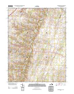
2013 Map of Stephenson
USGS Topo · Published 2013About this map
Opequon Creek meanders through this landscape, providing a central artery for several historic crossings including Seivers Ford and Tanquarys Ford. This 2013 survey of the region northeast of Winchester shows a mix of established rural settlements and newer estate developments. Longstanding communities such as Jordan Springs, Burnt Factory, and Mount Pleasant are interspersed with modern residential clusters like Greenwood Heights and The Cottage Estate. The topography is marked by the Devils Backbone ridge, while the local infrastructure supports diverse activity from the High View Farm Airport to the industrial presence at Freyco. The pattern of roads like Old Wagon Road and Mill Race Drive suggests a deep history of movement and early industry along watercourses like Abrams Creek and Redbud Run.
Find a feature on this map
185 named features on this map. Tap any name to fly to it.
Don’t see what you’re looking for? This feature index may not catch every label — zoom into the map to look around manually.
Map Details
Editions of this 2013 Stephenson Map
This is the sole edition of this map. No revisions or reprints were ever made.
Other maps of this area

1884 · Harpers Ferry
USGS Topo · 1:125,000

1891 · Harpers Ferry
USGS Topo · 1:125,000

1893 · Harpers Ferry
USGS Topo · 1:125,000

1894 · Winchester
USGS Topo · 1:125,000

1914 · Martinsburg
USGS Topo · 1:48,000

1914 · Gerrardstown
USGS Topo · 1:48,000

1916 · Gerrardstown
USGS Topo · 1:62,500

1916 · Martinsburg
USGS Topo · 1:62,500

1916 · Berryville
USGS Topo · 1:62,500

1937 · Gerrardstown
USGS Topo · 1:48,000