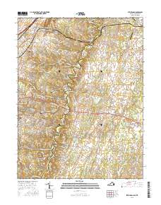
2016 Map of Stephenson
USGS Topo · Published 2016About this map
Opequon Creek meanders through the heart of this landscape, forming a natural boundary near the community of Burnt Factory. The area is defined by a series of small, scattered settlements including Stephenson, Jordan Springs, and Leetown, which are connected by a network of historic transit routes like the Martinsburg Pike and Old Charles Town Rd. The presence of numerous burial grounds, such as Stones Chapel Cem and Old Salem Cem, reflects the deep-rooted local history of the Frederick Co and Clarke Co borderlands.
Find a feature on this map
146 named features on this map. Tap any name to fly to it.
Don’t see what you’re looking for? This feature index may not catch every label — zoom into the map to look around manually.
Map Details
Editions of this 2016 Stephenson Map
This is the sole edition of this map. No revisions or reprints were ever made.
Other maps of this area

1884 · Harpers Ferry
USGS Topo · 1:125,000

1891 · Harpers Ferry
USGS Topo · 1:125,000

1893 · Harpers Ferry
USGS Topo · 1:125,000

1894 · Winchester
USGS Topo · 1:125,000

1914 · Martinsburg
USGS Topo · 1:48,000

1914 · Gerrardstown
USGS Topo · 1:48,000

1916 · Gerrardstown
USGS Topo · 1:62,500

1916 · Martinsburg
USGS Topo · 1:62,500

1916 · Berryville
USGS Topo · 1:62,500

1937 · Gerrardstown
USGS Topo · 1:48,000