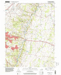
1997 Map of Stephenson
USGS Topo · Published 2001About this map
Opequon Creek meanders along the boundary of Frederick and Clarke Counties, serving as a central geographic anchor for this 1990s landscape. The map captures the suburban expansion of residential developments like Shenandoah Hills and Greenwood Heights alongside long-standing rural landmarks. For local historians, the sheet offers a clear look at the spiritual and educational infrastructure of the era, including the Holy Trinity Mission Seminary, Stonewall Sch, and the Emmanuel Ch in Stephenson.
Find a feature on this map
56 named features on this map. Tap any name to fly to it.
Don’t see what you’re looking for? This feature index may not catch every label — zoom into the map to look around manually.
Map Details
Editions of this 1997 Stephenson Map
This is the sole edition of this map. No revisions or reprints were ever made.
Other maps of this area

1884 · Harpers Ferry
USGS Topo · 1:125,000

1891 · Harpers Ferry
USGS Topo · 1:125,000

1893 · Harpers Ferry
USGS Topo · 1:125,000

1894 · Winchester
USGS Topo · 1:125,000

1914 · Martinsburg
USGS Topo · 1:48,000

1914 · Gerrardstown
USGS Topo · 1:48,000

1916 · Gerrardstown
USGS Topo · 1:62,500

1916 · Martinsburg
USGS Topo · 1:62,500

1916 · Berryville
USGS Topo · 1:62,500

1937 · Gerrardstown
USGS Topo · 1:48,000