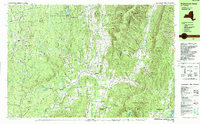
1988 Map of Stephentown Center
USGS Topo · Published 1988About this map
The Taconic Range and its complex topography dominate this late 1980s landscape at the New York and Massachusetts border. Small rural hamlets and agricultural pockets like Stephentown Center and West Stephentown are concentrated in the valley floors, while the steep ridgelines of Saddleback Ridge and Brodie Mtn remain largely forested. The map reveals a transition toward recreation-based land use, evidenced by the development of the Jiminy Peak Ski Area and Brodie Mtn Ski Area along the high eastern peaks.
Find a feature on this map
78 named features on this map. Tap any name to fly to it.
Don’t see what you’re looking for? This feature index may not catch every label — zoom into the map to look around manually.
Map Details
Editions of this 1988 Stephentown Center Map
This is the sole edition of this map. No revisions or reprints were ever made.
Other maps of this area

1886 · Greylock
USGS Topo · 1:62,500

1886 · Becket
USGS Topo · 1:62,500

1888 · Becket
USGS Topo · 1:62,500

1888 · Berlin
USGS Topo · 1:62,500

1888 · Pittsfield
USGS Topo · 1:62,500

1890 · Pittsfield
USGS Topo · 1:62,500

1890 · Berlin
USGS Topo · 1:62,500

1891 · Greylock
USGS Topo · 1:62,500

1893 · Troy
USGS Topo · 1:62,500

1893 · Becket
USGS Topo · 1:62,500