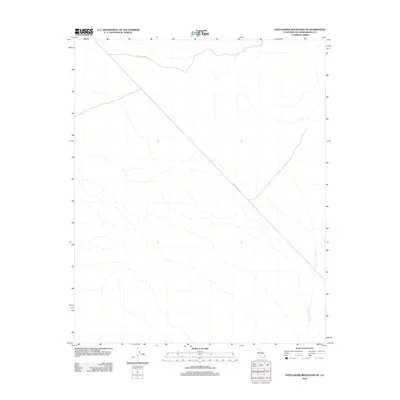
2012 Map of Stepladder Mountains NE
USGS Topo · Published 2012About this map
Chemehuevi Wash defines the drainage patterns of this arid landscape in eastern San Bernardino County. The terrain is sparsely developed, marked primarily by essential transit and infrastructure corridors through the desert. These include Eagle Pass Rd cutting across the northern portion of the quadrangle and a long Utility Access Rd that runs diagonally across the central and southern reaches. This 2012 survey illustrates the remote character of the region where seasonal watercourses like the wash provide the primary topographic definition between the low-lying flats and the rising slopes of the surrounding mountain ranges.
Find a feature on this map
3 named features on this map. Tap any name to fly to it.
Don’t see what you’re looking for? This feature index may not catch every label — zoom into the map to look around manually.
Map Details
Editions of this 2012 Stepladder Mountains NE Map
This is the sole edition of this map. No revisions or reprints were ever made.
Other maps of this area

1903 · Needles
USGS Topo · 1:125,000

1904 · Needles Special
USGS Topo · 1:125,000

1943 · Center Hills
USGS Topo · 1:62,500

1943 · Bannock
USGS Topo · 1:62,500

1950 · Sawtooth Range
USGS Topo · 1:62,500

1950 · Needles
USGS Topo · 1:62,500

1951 · Sawtooth Range
USGS Topo · 1:62,500

1952 · Needles
USGS Topo · 1:62,500

1954 · Needles
USGS Topo · 1:250,000

1956 · Needles
USGS Topo · 1:250,000