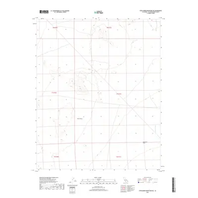
2018 Map of Stepladder Mountains NE
USGS Topo · Published 2018About this map
The arid landscape of the Mojave Desert characterizes this region of San Bernardino County, where the topography shifts toward the Chemehuevi Valley in the southeast. A primary hydrological feature is the Chemehuevi Wash, which drains through the lower quadrant of the map. This 2018 survey reveals a terrain largely defined by its natural drainage patterns and land divisions rather than human settlement, reflecting the remote nature of the California high desert. The absence of roads or structures emphasizes the preservation of the desert floor, with land management being a primary concern as shown by the various township and range boundaries including t8n r21e and t7n r20e. Researchers interested in environmental history or the specific geography of desert watersheds will find the precise mapping of these dry washes essential.
Find a feature on this map
9 named features on this map. Tap any name to fly to it.
Don’t see what you’re looking for? This feature index may not catch every label — zoom into the map to look around manually.
Map Details
Editions of this 2018 Stepladder Mountains NE Map
This is the sole edition of this map. No revisions or reprints were ever made.
Other maps of this area

1903 · Needles
USGS Topo · 1:125,000

1904 · Needles Special
USGS Topo · 1:125,000

1943 · Center Hills
USGS Topo · 1:62,500

1943 · Bannock
USGS Topo · 1:62,500

1950 · Sawtooth Range
USGS Topo · 1:62,500

1950 · Needles
USGS Topo · 1:62,500

1951 · Sawtooth Range
USGS Topo · 1:62,500

1952 · Needles
USGS Topo · 1:62,500

1954 · Needles
USGS Topo · 1:250,000

1956 · Needles
USGS Topo · 1:250,000