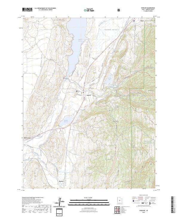
2023 Map of Sterling
USGS Topo · Published 2023About this map
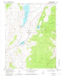
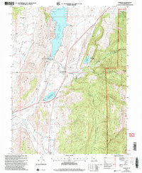
Sterling and the southern reaches of the Sanpete Valley are defined by a complex network of water management, where the San Pitch River and Twelvemile Creek feed into vital local catchments like Gunnison Reservoir and Ninemile Reservoir. This landscape reflects a long-standing agrarian reliance on gravity-fed irrigation, evidenced by the Lake Canal, Larson Ditch, and New Field Canal that lace through the valley floor. Settlement is clustered along the valley corridor, with the community of Mayfield to the south and the small village of Christianburg located west of the river.
Find a feature on this map
51 named features on this map. Tap any name to fly to it.
Don’t see what you’re looking for? This feature index may not catch every label — zoom into the map to look around manually.
Map Details
Editions of this 2023 Sterling Map
This is the sole edition of this map. No revisions or reprints were ever made.
Historical Maps of Mayfield Through Time
3 maps found