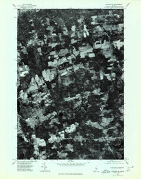
1975 Map of Stetson NW
USGS Topo · Published 1980About this map
Exeter Center and the surrounding rural crossroads of Penobscot County are captured in this mid-1970s orthophotoquad, which uses aerial photography to document the landscape of central Maine. The imagery reveals a mosaic of active agricultural clearings and dense woodlots characteristic of the region's late-twentieth-century land use. Small clusters of development are concentrated at historic junctions like Morse Corners and Exeter Corners, while the southern portion of the sheet shows the residential and commercial footprint of Stetson. This specific type of survey provides a rare visual record of property lines and vegetation patterns that traditional topographic maps often generalize, showing the literal state of the fields near Spragues Mill during the autumn of 1975.
Find a feature on this map
5 named features on this map. Tap any name to fly to it.
Don’t see what you’re looking for? This feature index may not catch every label — zoom into the map to look around manually.
Map Details
Editions of this 1975 Stetson NW Map
This is the sole edition of this map. No revisions or reprints were ever made.
Other maps of this area

1930 · Pittsfield
USGS Topo · 1:48,000

1931 · Stetson
USGS Topo · 1:48,000

1932 · Dover-Foxcroft
USGS Topo · 1:48,000

1932 · Pittsfield
USGS Topo · 1:62,500

1933 · Pittsfield
USGS Topo · 1:62,500

1933 · Guilford
USGS Topo · 1:62,500

1935 · Dover-Foxcroft
USGS Topo · 1:62,500

1935 · Stetson
USGS Topo · 1:62,500

1937 · Guilford
USGS Topo · 1:62,500

1948 · Bangor
USGS Topo · 1:250,000