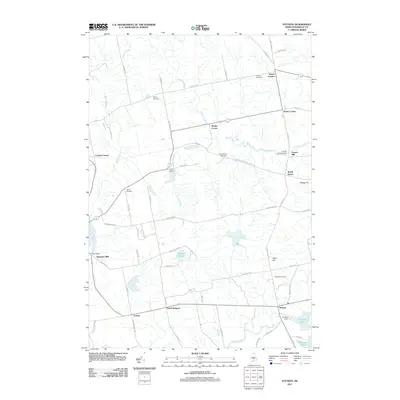
2011 Map of Stetson
USGS Topo · Published 2011About this map
Stetson and its surrounding rural hamlets are defined by the intricate drainage of French Stream and the Alder Stream valley in Penobscot County. The landscape is dotted with small agricultural and milling centers such as French Mill and Spragues Mill, connected by a network of local roads including Chamberlain Meeting House Rd and Greenbush Rd. Genealogists will find notable value in the distribution of family and community burial grounds, from Crowell Cemetery in the north to Clark Hill Cemetery near Clark Hill. The central part of the quadrangle shows the progression of these settlements at various junctions, including Exeter Corners, Exeter Center, and Stubbs Corner, reflecting the traditional crossroads development pattern of inland Maine. Managed water resources are evident at Archers Dam and Nason Dam, which regulate the flow near Pleasant Lake and the various streams feeding into the larger Penobscot watershed.
Find a feature on this map
70 named features on this map. Tap any name to fly to it.
Don’t see what you’re looking for? This feature index may not catch every label — zoom into the map to look around manually.
Map Details
Editions of this 2011 Stetson Map
This is the sole edition of this map. No revisions or reprints were ever made.
Other maps of this area

1930 · Pittsfield
USGS Topo · 1:48,000

1931 · Stetson
USGS Topo · 1:48,000

1932 · Dover-Foxcroft
USGS Topo · 1:48,000

1932 · Pittsfield
USGS Topo · 1:62,500

1933 · Pittsfield
USGS Topo · 1:62,500

1933 · Guilford
USGS Topo · 1:62,500

1935 · Dover-Foxcroft
USGS Topo · 1:62,500

1935 · Stetson
USGS Topo · 1:62,500

1937 · Guilford
USGS Topo · 1:62,500

1948 · Bangor
USGS Topo · 1:250,000