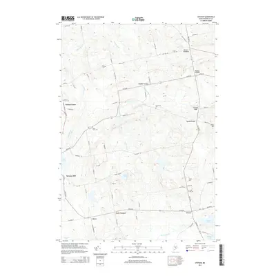
2014 Map of Stetson
USGS Topo · Published 2014About this map
Stetson and its surrounding rural landscapes are defined by a network of crossroad settlements and small-scale milling sites across Penobscot County. In the northern reaches, Exeter Center and Exeter Corners provide central nodes for the agricultural upland, while the western edge shows the transition toward Corinna Center. The map reveals an economy historically tied to water power, evident in place names like French Mill on French Stream and Spragues Mill along the Alder Stream.
Find a feature on this map
72 named features on this map. Tap any name to fly to it.
Don’t see what you’re looking for? This feature index may not catch every label — zoom into the map to look around manually.
Map Details
Editions of this 2014 Stetson Map
This is the sole edition of this map. No revisions or reprints were ever made.
Other maps of this area

1930 · Pittsfield
USGS Topo · 1:48,000

1931 · Stetson
USGS Topo · 1:48,000

1932 · Dover-Foxcroft
USGS Topo · 1:48,000

1932 · Pittsfield
USGS Topo · 1:62,500

1933 · Pittsfield
USGS Topo · 1:62,500

1933 · Guilford
USGS Topo · 1:62,500

1935 · Dover-Foxcroft
USGS Topo · 1:62,500

1935 · Stetson
USGS Topo · 1:62,500

1937 · Guilford
USGS Topo · 1:62,500

1948 · Bangor
USGS Topo · 1:250,000