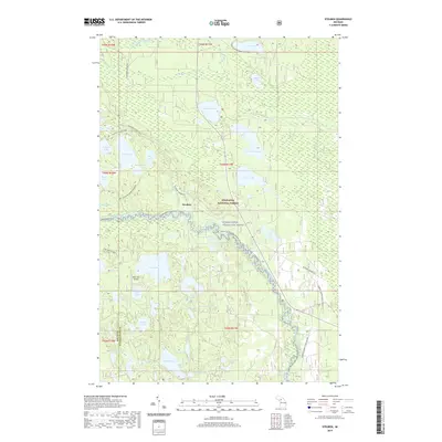
2019 Map of Steuben
USGS Topo · Published 2019About this map
Steuben serves as a central point of settlement within this portion of the Hiawatha National Forest. This interior region of the Upper Peninsula is defined by an intricate network of glacial lakes and wetlands, including Steuben Lake, Colwell Lake, and Byers Lake. The drainage is primarily managed by the Indian River, which is designated here as the Indian Wild and Scenic River. The map highlights a transition in land use from traditional forestry and water travel to modern recreation, visible in the presence of the Indian River Canoe Route and the Bass Lake Airport. Grounded in the region's logging history, the Haywire Grade ATV follows a former rail corridor, while numerous specialized paths like the Pine Marten Run and Clear Lake Interpretive Trail weave through the township. The boundary between Delta and Schoolcraft counties runs through the western section, bisecting a landscape rich with family-named water bodies like Nevilles Lake and Brevick Lake.
Find a feature on this map
56 named features on this map. Tap any name to fly to it.
Don’t see what you’re looking for? This feature index may not catch every label — zoom into the map to look around manually.
Map Details
Editions of this 2019 Steuben Map
This is the sole edition of this map. No revisions or reprints were ever made.
Other maps of this area

1931 · Steuben SE
USGS Topo · 1:31,680

1931 · Steuben SW
USGS Topo · 1:31,680

1931 · Steuben NE
USGS Topo · 1:31,680

1931 · Shingleton SW
USGS Topo · 1:31,680

1931 · Steuben NW
USGS Topo · 1:31,680

1931 · Skeels Lake NE
USGS Topo · 1:31,680

1931 · Shingleton SE
USGS Topo · 1:31,680

1931 · Munising SE
USGS Topo · 1:31,680

1932 · Skeels Lake SE
USGS Topo · 1:31,680

1958 · Corner Lake
USGS Topo · 1:62,500