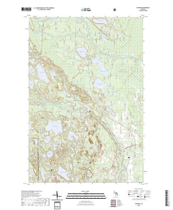
2023 Map of Steuben
USGS Topo · Published 2023About this map
The settlement of Steuben serves as a focal point in this portion of the Hiawatha National Forest, where the landscape is defined by a complex network of glacial lakes and wetlands. The protected Big Island Lake Wilderness dominates the western side of the map, preserving a cluster of water bodies including Byers Lake, Twilight Lake, and Jarr Lake. This environment supports specialized infrastructure like the Bass Lake Airport, which sits adjacent to Bass Lake.
Find a feature on this map
57 named features on this map. Tap any name to fly to it.
Don’t see what you’re looking for? This feature index may not catch every label — zoom into the map to look around manually.
Map Details
Editions of this 2023 Steuben Map
This is the sole edition of this map. No revisions or reprints were ever made.
Other maps of this area

1931 · Steuben SE
USGS Topo · 1:31,680

1931 · Steuben SW
USGS Topo · 1:31,680

1931 · Steuben NE
USGS Topo · 1:31,680

1931 · Shingleton SW
USGS Topo · 1:31,680

1931 · Steuben NW
USGS Topo · 1:31,680

1931 · Skeels Lake NE
USGS Topo · 1:31,680

1931 · Shingleton SE
USGS Topo · 1:31,680

1931 · Munising SE
USGS Topo · 1:31,680

1932 · Skeels Lake SE
USGS Topo · 1:31,680

1958 · Corner Lake
USGS Topo · 1:62,500