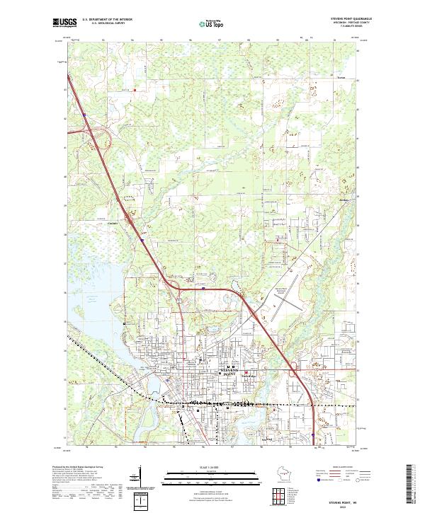
2022 Map of Stevens Point
USGS Topo · Published 2022About this map
The Wisconsin River corridor defines this portion of Portage County, where the industrial and educational hub of Stevens Point sits at the center of a complex network of waterways and trails. The city's civic core is anchored by the Portage County Courthouse, with the expansive campuses of the University of Wisconsin - Stevens Point and Mid - State Technical College - Stevens Point driving the local geography. To the south, the village of Whiting and the neighborhood of Park Ridge border the impounded waters of McDill Pond and the Plover River.
Find a feature on this map
94 named features on this map. Tap any name to fly to it.
Don’t see what you’re looking for? This feature index may not catch every label — zoom into the map to look around manually.
Map Details
Editions of this 2022 Stevens Point Map
This is the sole edition of this map. No revisions or reprints were ever made.
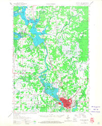
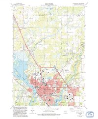
Historical Maps of Park Ridge Through Time
3 maps found