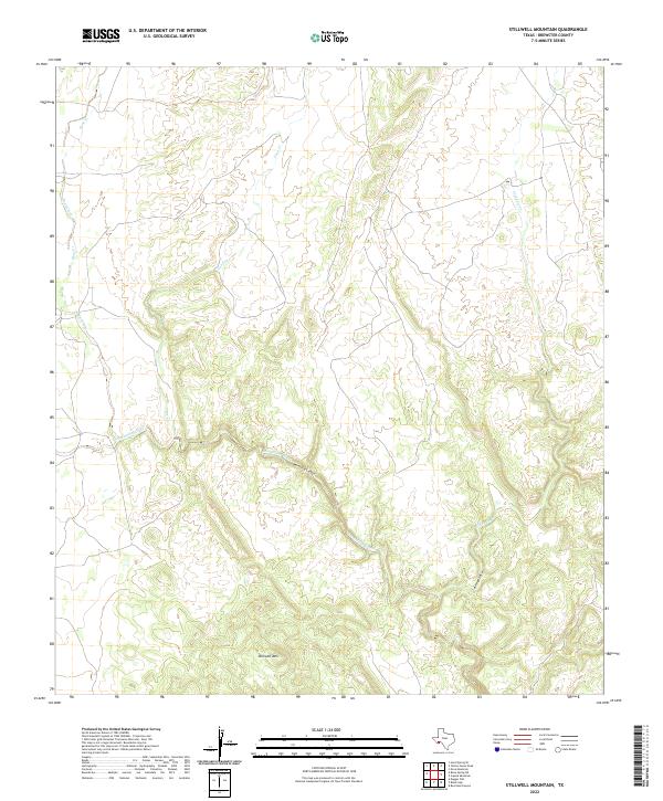
2022 Map of Stillwell Mountain
USGS Topo · Published 2022About this map
Stillwell Mountain rises above a desert landscape defined by deeply incised drainages and dramatic geological features in this Brewster County region. The primary drainage, Maravillas Creek, carves through the winding Maravillas Canyon, creating a complex network of seasonal waterways that draw from the surrounding high ground. These ephemeral watercourses, including Bear Creek, Guayule Cr, and Arroyo Seco, illustrate the characteristic erosional patterns of the Trans-Pecos terrain. With no major settlements or highways present, the map highlights the isolation of this corner of Texas, where the land is primarily shaped by the relief of the mountain and its descending arroyos. This survey provides an essential view for understanding the topography of the Big Bend area before more modern developments or land use changes might alter these remote water systems.
Find a feature on this map
8 named features on this map. Tap any name to fly to it.
Don’t see what you’re looking for? This feature index may not catch every label — zoom into the map to look around manually.
Map Details
Editions of this 2022 Stillwell Mountain Map
This is the sole edition of this map. No revisions or reprints were ever made.
Other maps of this area

1917 · Bone Spring
USGS Topo · 1:62,500

1917 · Hood Spring
USGS Topo · 1:62,500

1918 · Bone Spring
USGS Topo · 1:125,000

1918 · Hood Spring
USGS Topo · 1:62,500

1918 · Dove Mountain
USGS Topo · 1:62,500

1918 · Bone Spring
USGS Topo · 1:62,500

1919 · Maravillas Canyon
USGS Topo · 1:62,500

1920 · Bone Spring
USGS Topo · 1:62,500

1931 · Hood Spring
USGS Topo · 1:62,500

1959 · Emory Peak
USGS Topo · 1:250,000