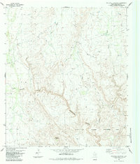
1983 Map of Stillwell Mountain
USGS Topo · Published 1984About this map
Stillwell Ranch and the high desert terrain of Brewster County define this 1983 survey, which captures a landscape shaped by intermittent water and conservation efforts. The southern portion of the sheet is dominated by the Black Gap Wildlife Management Area, showing the protected lands surrounding the dramatic descent into Maravillas Canyon. This area is characterized by a complex network of ephemeral drainages, including Maravillas Creek, Guayule Creek, and Arroyo Seco, which carve through the limestone-rich topography.
Find a feature on this map
18 named features on this map. Tap any name to fly to it.
Don’t see what you’re looking for? This feature index may not catch every label — zoom into the map to look around manually.
Map Details
Editions of this 1983 Stillwell Mountain Map
This is the sole edition of this map. No revisions or reprints were ever made.
Other maps of this area

1917 · Bone Spring
USGS Topo · 1:62,500

1917 · Hood Spring
USGS Topo · 1:62,500

1918 · Bone Spring
USGS Topo · 1:125,000

1918 · Hood Spring
USGS Topo · 1:62,500

1918 · Dove Mountain
USGS Topo · 1:62,500

1918 · Bone Spring
USGS Topo · 1:62,500

1919 · Maravillas Canyon
USGS Topo · 1:62,500

1920 · Bone Spring
USGS Topo · 1:62,500

1931 · Hood Spring
USGS Topo · 1:62,500

1959 · Emory Peak
USGS Topo · 1:250,000