1953 Map of Stinking Spring Creek 2 SE
USGS Topo · Published 1953About this map
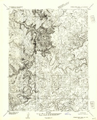
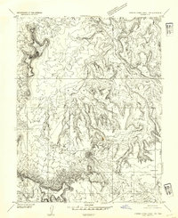
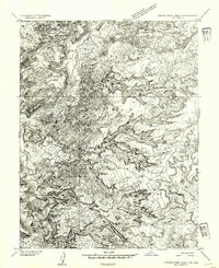
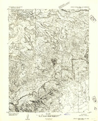
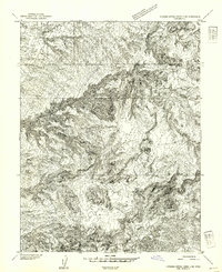
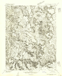
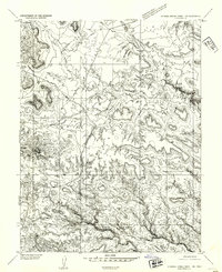
The San Rafael Swell dominates this mid-century topographic study, revealing a complex landscape of erosion and uplift in central Utah. The map focuses on the high-relief terrain where the Hidden Valley cuts through the sedimentary layers, creating a labyrinth of ridges and drainages. Human presence is sparse, marked primarily by the isolated Swazy Cabin, suggesting the area's history of seasonal livestock grazing or lone prospecting. Distinctive landmarks such as Ghost Rock and Family Butte rise above the surrounding washes, providing essential orientation points in an otherwise intricate geography of sandstone and limestone. The drainage patterns of Georges Draw, Earls Draw, and Red Wash illustrate the hydraulic forces that have carved this portion of the Emery County backcountry, long before modern infrastructure reached deep into these interior valleys.
Find a feature on this map
9 named features on this map. Tap any name to fly to it.
Don’t see what you’re looking for? This feature index may not catch every label — zoom into the map to look around manually.
Map Details
Editions of this 1953 Stinking Spring Creek 2 SE Map
This is the sole edition of this map. No revisions or reprints were ever made.
Other maps of this area

1885 · San Rafael
USGS Topo · 1:250,000
1952 · Wild Horse
USGS Topo · 1:62,500
1952 · San Rafael Knob
USGS Topo · 1:62,500
1953 · Temple Mtn
USGS Topo · 1:62,500
1954 · Stinking Spring Creek 1 NW
USGS Topo · 1:24,000
1954 · Stinking Spring Creek 3 NW
USGS Topo · 1:24,000
1954 · Stinking Spring Creek 4 NW
USGS Topo · 1:24,000
1954 · Stinking Spring Creek 2 SW
USGS Topo · 1:24,000
1954 · Stinking Spring Creek 2 NE
USGS Topo · 1:24,000
1954 · Stinking Spring Creek 1 SW
USGS Topo · 1:24,000