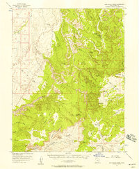
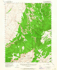
1952 Map of San Rafael Knob
USGS Topo · Published 1958About this map
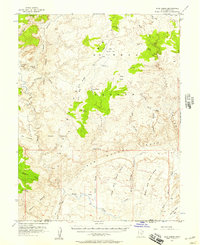
San Rafael Knob dominates the high desert landscape of central Utah on this mid-century survey, surrounded by an intricate network of deep washes and canyons. The presence of Swazy Cabin and the Lucky Strike Mine provides a rare look at the human activity within this isolated terrain, while the Landing Strip near Rods Valley suggests the era's reliance on air travel for reaching such remote locations.
Find a feature on this map
52 named features on this map. Tap any name to fly to it.
Don’t see what you’re looking for? This feature index may not catch every label — zoom into the map to look around manually.
Map Details
Editions of this 1952 San Rafael Knob Map
2 editions found
Other maps of this area

1885 · San Rafael
USGS Topo · 1:250,000

1885 · Manti
USGS Topo · 1:250,000

1885 · Fish Lake
USGS Topo · 1:250,000

1886 · Price River
USGS Topo · 1:250,000

1895 · Manti
USGS Topo · 1:250,000

1896 · Price River
USGS Topo · 1:250,000

1896 · Fish Lake
USGS Topo · 1:250,000
1923 · Castle Dale
USGS Topo · 1:62,500
1925 · Castle Dale
USGS Topo · 1:62,500
1952 · Wild Horse
USGS Topo · 1:62,500