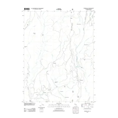
2012 Map of Stirling City
USGS Topo · Published 2012About this map
Stirling City and the high ridge country between the W Br Feather River and Butte Cr define this 2012 topographic study of the northern Sierra Nevada foothills. The map documents a landscape where timber history and early settlement patterns remain visible through contemporary road networks like the Skyway. Genealogists and local historians can locate early burial sites at Inskip Pioneer Cem and Coutolenc Cem, which serve as quiet markers of the area's development. Small communities and historical staging points such as Lovelock, Toadtown, and Inskip are threaded together by a complex web of mountain roads including Humbug RD and Lovelock RD. The terrain is deeply incised by drainages like Last Chance Cr and Inskip Cr, with distinctive named heights including Cape Horn and Portuguese Point providing landmarks for those tracing the rural geography of Butte County.
Find a feature on this map
72 named features on this map. Tap any name to fly to it.
Don’t see what you’re looking for? This feature index may not catch every label — zoom into the map to look around manually.
Map Details
Editions of this 2012 Stirling City Map
This is the sole edition of this map. No revisions or reprints were ever made.
Other maps of this area

1886 · Lassen Peak
USGS Topo · 1:250,000

1888 · Bidwell Bar
USGS Topo · 1:125,000

1891 · Bidwell Bar
USGS Topo · 1:125,000

1891 · Chico
USGS Topo · 1:125,000

1892 · Lassen Peak
USGS Topo · 1:250,000

1893 · Chico
USGS Topo · 1:125,000

1893 · Bidwell Bar
USGS Topo · 1:125,000

1894 · Lassen Peak
USGS Topo · 1:250,000

1895 · Bidwell Bar
USGS Topo · 1:125,000

1895 · Chico
USGS Topo · 1:125,000