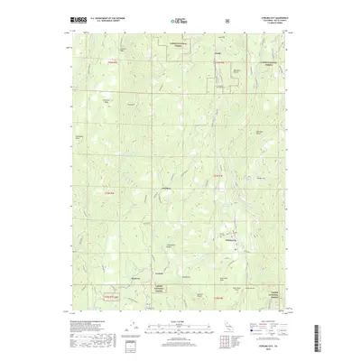
2018 Map of Stirling City
USGS Topo · Published 2018About this map
Stirling City serves as the primary hub within this northern California landscape, which transitions from the forest-lined settlements of the lower ridges into the higher reaches of the Lassen National Forest. The map documents a cluster of historical communities along the ridgelines, including Powellton, Lovelock, and the curiously named Toadtown. These settlements are linked by a network of mountain roads such as Skyway Rd and Powelltown Rd, following the natural contours between deep ravines and the headwaters of the W Br Feather River.
Find a feature on this map
74 named features on this map. Tap any name to fly to it.
Don’t see what you’re looking for? This feature index may not catch every label — zoom into the map to look around manually.
Map Details
Editions of this 2018 Stirling City Map
This is the sole edition of this map. No revisions or reprints were ever made.
Other maps of this area

1886 · Lassen Peak
USGS Topo · 1:250,000

1888 · Bidwell Bar
USGS Topo · 1:125,000

1891 · Bidwell Bar
USGS Topo · 1:125,000

1891 · Chico
USGS Topo · 1:125,000

1892 · Lassen Peak
USGS Topo · 1:250,000

1893 · Chico
USGS Topo · 1:125,000

1893 · Bidwell Bar
USGS Topo · 1:125,000

1894 · Lassen Peak
USGS Topo · 1:250,000

1895 · Bidwell Bar
USGS Topo · 1:125,000

1895 · Chico
USGS Topo · 1:125,000