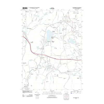
2012 Map of Stockbridge
USGS Topo · Published 2012About this map
The Housatonic River snakes through this Berkshire County landscape, anchoring a series of historic villages including Stockbridge, Glendale, and Housatonic. The area is defined by its long-standing cultural institutions and grand estates, most notably Tanglewood and the Boston University Tanglewood Institute, alongside the grounds of Wheatleigh. The map documents a complex social geography through its numerous cemeteries, such as the Church on the Hill Cem and Saint Marys Cem, reflecting the diverse community history of these valley settlements.
Find a feature on this map
206 named features on this map. Tap any name to fly to it.
Don’t see what you’re looking for? This feature index may not catch every label — zoom into the map to look around manually.
Map Details
Editions of this 2012 Stockbridge Map
This is the sole edition of this map. No revisions or reprints were ever made.
Other maps of this area

1885 · Sheffield
USGS Topo · 1:62,500

1886 · Becket
USGS Topo · 1:62,500

1888 · Sheffield
USGS Topo · 1:62,500

1888 · Becket
USGS Topo · 1:62,500

1888 · Sandisfield
USGS Topo · 1:62,500

1888 · Pittsfield
USGS Topo · 1:62,500

1890 · Pittsfield
USGS Topo · 1:62,500

1891 · Sheffield
USGS Topo · 1:62,500

1893 · Becket
USGS Topo · 1:62,500

1893 · Sheffield
USGS Topo · 1:62,500