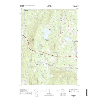
2018 Map of Stockbridge
USGS Topo · Published 2018About this map
Stockbridge and its surrounding villages sit within a landscape defined by the winding Housatonic River and the significant water body of Stockbridge Bowl. The area maintains a high concentration of established sites, including Saint Josephs Cemetery and Stockbridge Cemetery, reflecting generations of local history. The town center is complemented by the smaller settlements of Glendale, South Lee, and Interlaken, each situated along the valley's watercourses and the Housatonic Railroad.
Find a feature on this map
152 named features on this map. Tap any name to fly to it.
Don’t see what you’re looking for? This feature index may not catch every label — zoom into the map to look around manually.
Map Details
Editions of this 2018 Stockbridge Map
This is the sole edition of this map. No revisions or reprints were ever made.
Other maps of this area

1885 · Sheffield
USGS Topo · 1:62,500

1886 · Becket
USGS Topo · 1:62,500

1888 · Sheffield
USGS Topo · 1:62,500

1888 · Becket
USGS Topo · 1:62,500

1888 · Sandisfield
USGS Topo · 1:62,500

1888 · Pittsfield
USGS Topo · 1:62,500

1890 · Pittsfield
USGS Topo · 1:62,500

1891 · Sheffield
USGS Topo · 1:62,500

1893 · Becket
USGS Topo · 1:62,500

1893 · Sheffield
USGS Topo · 1:62,500