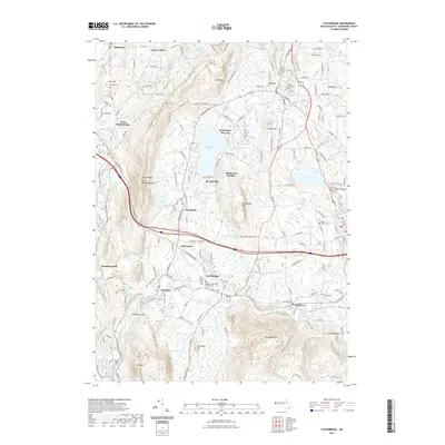
2021 Map of Stockbridge
USGS Topo · Published 2021About this map
The Taconic Range and Yokun Ridge frame a landscape defined by the winding Housatonic River and the significant cultural hubs of central Berkshire County. This modern survey illustrates the persistent settlement patterns of historic villages like Stockbridge, Interlaken, and Glendale, alongside the large recreational waters of the Stockbridge Bowl. The topography reveals the steep rise of Monument Mtn and Beartown Mtn, which hem in the valley's transit corridors. Cultural and genealogical markers are numerous, including the Stockbridge Cem and several parish burial grounds such as Saint Anns Cem. The presence of Iron Mine Rd and the Housatonic Railroad points to the region's long industrial history, while landmarks like Camp Mah-Kee-Nac reflect its more recent identity as a premier seasonal retreat.
Find a feature on this map
212 named features on this map. Tap any name to fly to it.
Don’t see what you’re looking for? This feature index may not catch every label — zoom into the map to look around manually.
Map Details
Editions of this 2021 Stockbridge Map
This is the sole edition of this map. No revisions or reprints were ever made.
Other maps of this area

1885 · Sheffield
USGS Topo · 1:62,500

1886 · Becket
USGS Topo · 1:62,500

1888 · Sheffield
USGS Topo · 1:62,500

1888 · Becket
USGS Topo · 1:62,500

1888 · Sandisfield
USGS Topo · 1:62,500

1888 · Pittsfield
USGS Topo · 1:62,500

1890 · Pittsfield
USGS Topo · 1:62,500

1891 · Sheffield
USGS Topo · 1:62,500

1893 · Becket
USGS Topo · 1:62,500

1893 · Sheffield
USGS Topo · 1:62,500