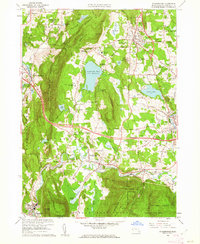
1959 Map of Stockbridge
USGS Topo · Published 1962About this map
Tanglewood Auditorium and the surrounding cultural landscape of the southern Berkshires are captured here just as the modern interstate era was beginning. The map details a unique concentration of religious and educational institutions, including the Shadowbrook Novitiate, The Marian Fathers Monastery, and Our Lady of Mercy Seminary. This 1959 revision illustrates the complex transportation network where the Massachusetts Turnpike cuts across the established routes of the New York New Haven and Hartford RR.
Find a feature on this map
76 named features on this map. Tap any name to fly to it.
Don’t see what you’re looking for? This feature index may not catch every label — zoom into the map to look around manually.
Map Details
Editions of this 1959 Stockbridge Map
2 editions found
Other maps of this area

1885 · Sheffield
USGS Topo · 1:62,500

1886 · Becket
USGS Topo · 1:62,500

1888 · Sheffield
USGS Topo · 1:62,500

1888 · Becket
USGS Topo · 1:62,500

1888 · Sandisfield
USGS Topo · 1:62,500

1888 · Pittsfield
USGS Topo · 1:62,500

1890 · Pittsfield
USGS Topo · 1:62,500

1891 · Sheffield
USGS Topo · 1:62,500

1893 · Becket
USGS Topo · 1:62,500

1893 · Sheffield
USGS Topo · 1:62,500