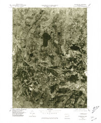
1975 Map of Stockbridge
USGS Topo · Published 1981About this map
Stockbridge and its neighboring Berkshire towns are captured in this mid-1970s orthophotoquad, which uses aerial photography to document the landscape and settlement patterns of the era. The dark expanse of the Stockbridge Bowl sits at the center of the sheet, surrounded by the wooded hills and clearings of West Stockbridge and Lenox. Following the valley floor, the Housatonic River winds through the southern portion of the map, passing by the village of Housatonic. This orthophoto format provides a clear record of land use during a period of Berkshire development, showing the density of town centers like Lee in contrast to the surrounding forested uplands. The imagery, captured by the Commonwealth of Massachusetts Department of Public Works and the USGS, reflects the early-modern transition of these historic mill and resort towns into their contemporary configurations.
Find a feature on this map
7 named features on this map. Tap any name to fly to it.
Don’t see what you’re looking for? This feature index may not catch every label — zoom into the map to look around manually.
Map Details
Editions of this 1975 Stockbridge Map
This is the sole edition of this map. No revisions or reprints were ever made.
Other maps of this area

1885 · Sheffield
USGS Topo · 1:62,500

1886 · Becket
USGS Topo · 1:62,500

1888 · Sheffield
USGS Topo · 1:62,500

1888 · Becket
USGS Topo · 1:62,500

1888 · Sandisfield
USGS Topo · 1:62,500

1888 · Pittsfield
USGS Topo · 1:62,500

1890 · Pittsfield
USGS Topo · 1:62,500

1891 · Sheffield
USGS Topo · 1:62,500

1893 · Becket
USGS Topo · 1:62,500

1893 · Sheffield
USGS Topo · 1:62,500