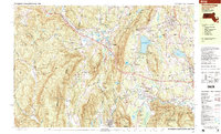
1997 Map of Stockbridge
USGS Topo · Published 1999About this map
Stockbridge and its surrounding villages appear in detail on this late-1990s survey, documenting the enduring cultural and industrial character of the Berkshires. The landscape is defined by the winding Housatonic River as it moves through Glendale, Housatonic, and South Lee, passing landmarks like the Ice Glen and Monument Mountain. The region’s history of mineral extraction is preserved through labels for the Richmond Furnace, Hudson Ore Bed Pond, and various Gravel Pits, while its evolution into a center for arts and education is evidenced by the Tanglewood Auditorium and Berkshire Christian College. The map captures the complex water network including the Stockbridge Bowl (Lake Mahkeenac) and Laurel Lake. Transit corridors like the Massachusetts Turnpike and the Conrail line cut through the terrain near West Stockbridge Mountain, showing the modern infrastructure overlaying the historic settlement patterns of Austerlitz and Larrywaug.
Find a feature on this map
82 named features on this map. Tap any name to fly to it.
Don’t see what you’re looking for? This feature index may not catch every label — zoom into the map to look around manually.
Map Details
Editions of this 1997 Stockbridge Map
This is the sole edition of this map. No revisions or reprints were ever made.
Other maps of this area

1885 · Sheffield
USGS Topo · 1:62,500

1886 · Becket
USGS Topo · 1:62,500

1888 · Sheffield
USGS Topo · 1:62,500

1888 · Becket
USGS Topo · 1:62,500

1888 · Sandisfield
USGS Topo · 1:62,500

1888 · Pittsfield
USGS Topo · 1:62,500

1890 · Pittsfield
USGS Topo · 1:62,500

1891 · Sheffield
USGS Topo · 1:62,500

1893 · Becket
USGS Topo · 1:62,500

1893 · Sheffield
USGS Topo · 1:62,500