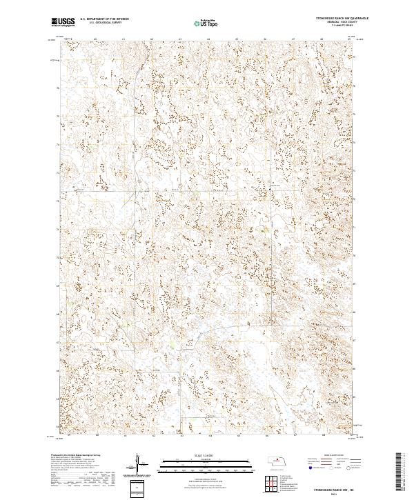
2021 Map of Stonehouse Ranch NW
USGS Topo · Published 2021About this map
Rose Hill Cem stands as a quiet focal point in this portion of Rock County, situated along 453rd Ave north of 854th Rd. The landscape is defined by the expansive Gracie Flats in the southeast, a terrain marked by numerous small, unnamed wetlands and ponds characteristic of the Nebraska Sandhills. This 2021 survey reveals a sparse, rural grid of section-line roads, including Fawn Rd and 850th Rd, which navigate a region dominated by ranching and open land. The arrangement of these roads and the location of the cemetery suggest the enduring, low-density settlement patterns of the high plains, where large tracts of land are partitioned into townships like t26n r18w and t25n r18w.
Find a feature on this map
14 named features on this map. Tap any name to fly to it.
Don’t see what you’re looking for? This feature index may not catch every label — zoom into the map to look around manually.
Map Details
Editions of this 2021 Stonehouse Ranch NW Map
This is the sole edition of this map. No revisions or reprints were ever made.
Other maps of this area

1955 · O'Neill
USGS Topo · 1:250,000

1959 · O'Neill
USGS Topo · 1:250,000

1969 · O'Neill
USGS Topo · 1:250,000

1981 · Stonehouse Ranch NW
USGS Topo · 1:24,000

1981 · Stonehouse Ranch NE
USGS Topo · 1:24,000
1981 · Shovel Dot Ranch
USGS Topo · 1:24,000
1981 · Stonehouse Ranch
USGS Topo · 1:24,000
1981 · Stonehouse Ranch SW
USGS Topo · 1:24,000

1981 · Rose
USGS Topo · 1:24,000

1982 · Stockdale Lake
USGS Topo · 1:24,000