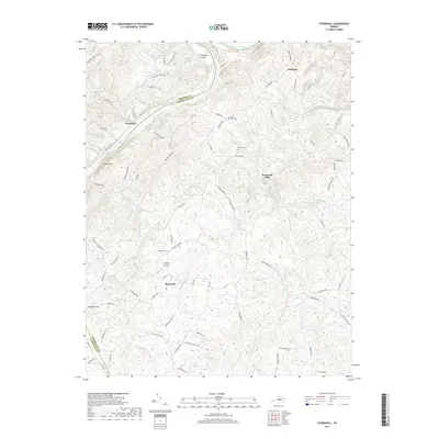
2019 Map of Stonewall
USGS Topo · Published 2019About this map
The James River snakes through the northern reach of this quadrangle, defining the boundary between Amherst and Appomattox Counties. Small rural hubs such as Stapleton, Beckham, and Stonewall Mills are scattered across a landscape carved by a dense network of tributaries including Wreck Island Creek and Stonewall Cr. The terrain is characterized by prominent rises like Turner Mtn and the river feature of Pettyjohn Island. Local history is preserved in the location of family and community sites like Mount Zion Cem and Rebecca Cem, while the presence of Skovhus Airport and Winery Ln near Stonewall reflects the modern agricultural and transportation character of the region. The transition from the high ground of Paradise Ridge down to the creek beds illustrates the complex drainage patterns of the central Virginia Piedmont.
Find a feature on this map
89 named features on this map. Tap any name to fly to it.
Don’t see what you’re looking for? This feature index may not catch every label — zoom into the map to look around manually.
Map Details
Editions of this 2019 Stonewall Map
This is the sole edition of this map. No revisions or reprints were ever made.
Other maps of this area

1892 · Lynchburg
USGS Topo · 1:125,000

1892 · Buckingham
USGS Topo · 1:125,000

1892 · Appomattox
USGS Topo · 1:125,000

1894 · Lexington
USGS Topo · 1:125,000

1935 · Amherst
USGS Topo · 1:48,000

1939 · Amherst
USGS Topo · 1:62,500

1944 · Lynchburg
USGS Topo · 1:62,500

1947 · Roanoke
USGS Topo · 1:250,000

1950 · Amherst
USGS Topo · 1:62,500

1950 · Lynchburg
USGS Topo · 1:62,500