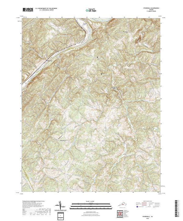
2022 Map of Stonewall
USGS Topo · Published 2022About this map
The James River winds through this central Virginia landscape, carving a boundary between Amherst and Appomattox counties while passing Pettyjohn Island. The settlement pattern centers on small communities like Beckham and Stapleton, with Stonewall Mills and Stonewall anchoring the interior. Local family history is preserved at the Mount Zion Baptist Church Cem and Rebecca Cem, which lie tucked among the many ridges and drainage basins of Wreck Island Cr and Stonewall Cr. The terrain is defined by elevations like Turner Mtn and Paradise Hill, while the Skovhus Airport provides a modern navigational landmark amidst the rural network of secondary roads such as Galts Mill Rd and Walkers Ford Rd. This area reflects the enduring geography of the Virginia Piedmont, where small-scale settlements and family-named landmarks follow the contours of the river and its tributaries.
Find a feature on this map
78 named features on this map. Tap any name to fly to it.
Don’t see what you’re looking for? This feature index may not catch every label — zoom into the map to look around manually.
Map Details
Editions of this 2022 Stonewall Map
This is the sole edition of this map. No revisions or reprints were ever made.
Other maps of this area

1892 · Lynchburg
USGS Topo · 1:125,000

1892 · Buckingham
USGS Topo · 1:125,000

1892 · Appomattox
USGS Topo · 1:125,000

1894 · Lexington
USGS Topo · 1:125,000

1935 · Amherst
USGS Topo · 1:48,000

1939 · Amherst
USGS Topo · 1:62,500

1944 · Lynchburg
USGS Topo · 1:62,500

1947 · Roanoke
USGS Topo · 1:250,000

1950 · Amherst
USGS Topo · 1:62,500

1950 · Lynchburg
USGS Topo · 1:62,500