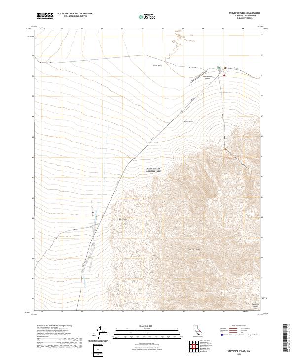
2021 Map of Stovepipe Wells
USGS Topo · Published 2021About this map
The Panamint Range dominates the southern portion of this desert landscape, where the elevation rises steeply toward the summit of Tucki Mtn. This high-contrast terrain is a defining characteristic of Death Valley National Park, where geological features like Mosaic Canyon and Black Point intersect with the vast lowlands of the Mojave Desert. The map captures the infrastructure supporting travel through this extreme environment, centered on the SR 190 corridor which serves as the primary artery for the region.
Find a feature on this map
12 named features on this map. Tap any name to fly to it.
Don’t see what you’re looking for? This feature index may not catch every label — zoom into the map to look around manually.
Map Details
Editions of this 2021 Stovepipe Wells Map
This is the sole edition of this map. No revisions or reprints were ever made.
Other maps of this area

1908 · Ballarat
USGS Topo · 1:250,000

1913 · Ballarat
USGS Topo · 1:250,000

1948 · Death Valley
USGS Topo · 1:250,000

1951 · Panamint Butte
USGS Topo · 1:62,500

1951 · Marble Canyon
USGS Topo · 1:62,500

1952 · Stovepipe Wells
USGS Topo · 1:62,500

1952 · Emigrant Canyon
USGS Topo · 1:62,500

1954 · Death Valley
USGS Topo · 1:250,000

1956 · Death Valley
USGS Topo · 1:250,000

1957 · Death Valley
USGS Topo · 1:250,000