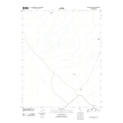
2012 Map of Stovepipe Wells NE
USGS Topo · Published 2012About this map
Titanothere Canyon and the Death Valley Buttes anchor the northern reaches of this Inyo County landscape, illustrating a region defined by dramatic elevation changes and ephemeral water systems. Drainage from the higher elevations flows toward the southwest, most notably through Salt Creek, while the Kit Fox Hills rise as a distinct landform in the central-east. The 2012 road network is represented by N Hwy and Daylight Pass Rd, which converge in the south near the mouth of Mud Canyon. This survey captures the desert floor and its surrounding peaks before significant modern developments, focusing on the natural topography and the essential transit corridors that connect these remote points of interest.
Find a feature on this map
7 named features on this map. Tap any name to fly to it.
Don’t see what you’re looking for? This feature index may not catch every label — zoom into the map to look around manually.
Map Details
Editions of this 2012 Stovepipe Wells NE Map
This is the sole edition of this map. No revisions or reprints were ever made.
Other maps of this area

1908 · Furnace Creek
USGS Topo · 1:250,000

1908 · Ballarat
USGS Topo · 1:250,000

1910 · Furnace Creek
USGS Topo · 1:250,000

1913 · Ballarat
USGS Topo · 1:250,000

1942 · Bullfrog
USGS Topo · 1:125,000

1948 · Death Valley
USGS Topo · 1:250,000

1952 · Chloride Cliff
USGS Topo · 1:50,000

1952 · Stovepipe Wells
USGS Topo · 1:62,500

1954 · Bullfrog
USGS Topo · 1:62,500

1954 · Death Valley
USGS Topo · 1:250,000