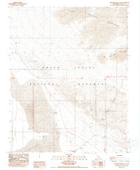
1988 Map of Stovepipe Wells NE
USGS Topo · Published 1988About this map
Death Valley National Monument reveals a landscape of extreme elevation shifts and desert hydrology in this late twentieth-century study. The area is defined by the sharp transition from the Grapevine Mountains in the northeast down to the expansive Mesquite Flat and the iconic Sand Dunes near Stovepipe Wells. The presence of Salt Creek and the Cornfield settlement area suggests the critical role of water sources in this arid environment. Surveyors meticulously recorded various bench marks, such as White Bank BM 112.4, alongside small human markers like a solitary Grave and a Picnic Area, highlighting the sparse but meaningful human footprint within the basin. Natural corridors like Mud Canyon and landmarks such as the Kit Fox Hills and Red Top provide essential orientation in a region of shifting sands and complex topography.
Find a feature on this map
22 named features on this map. Tap any name to fly to it.
Don’t see what you’re looking for? This feature index may not catch every label — zoom into the map to look around manually.
Map Details
Editions of this 1988 Stovepipe Wells NE Map
This is the sole edition of this map. No revisions or reprints were ever made.
Other maps of this area

1908 · Furnace Creek
USGS Topo · 1:250,000

1908 · Ballarat
USGS Topo · 1:250,000

1910 · Furnace Creek
USGS Topo · 1:250,000

1913 · Ballarat
USGS Topo · 1:250,000

1942 · Bullfrog
USGS Topo · 1:125,000

1948 · Death Valley
USGS Topo · 1:250,000

1952 · Chloride Cliff
USGS Topo · 1:50,000

1952 · Stovepipe Wells
USGS Topo · 1:62,500

1954 · Bullfrog
USGS Topo · 1:62,500

1954 · Death Valley
USGS Topo · 1:250,000