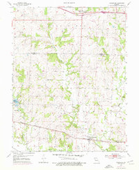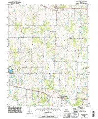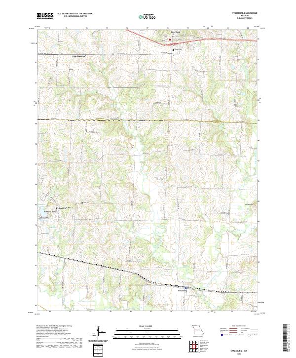
2021 Map of Strasburg
USGS Topo · Published 2021About this map
The boundary between Jackson Co and Cass Co bisects this Missouri landscape, where the headwaters of Crawford Cr and Big Cr drain a undulating terrain of ridge lines and creek bottoms. The northern reach is anchored by the community of Lone Jack, situated along US Hwy 50, while the southern portion features the established settlement of Strasburg and the eastern edge of Pleasant Hill. This 2021 survey illustrates a transition from the suburban margins of Lake Lotawana toward a more rural expanse defined by section-line roads and family-named landmarks. Local history is anchored by sites like Soldiers Cem near Lone Jack and Sloan Cem further south. Water management and recreation are evident at Baldwin Lake and Van Lake, positioned near Baldwin Park, while natural features like Devil-Ridge provide distinct topographic variety to the surrounding agricultural plains.
Find a feature on this map
87 named features on this map. Tap any name to fly to it.
Don’t see what you’re looking for? This feature index may not catch every label — zoom into the map to look around manually.
Map Details
Editions of this 2021 Strasburg Map
This is the sole edition of this map. No revisions or reprints were ever made.