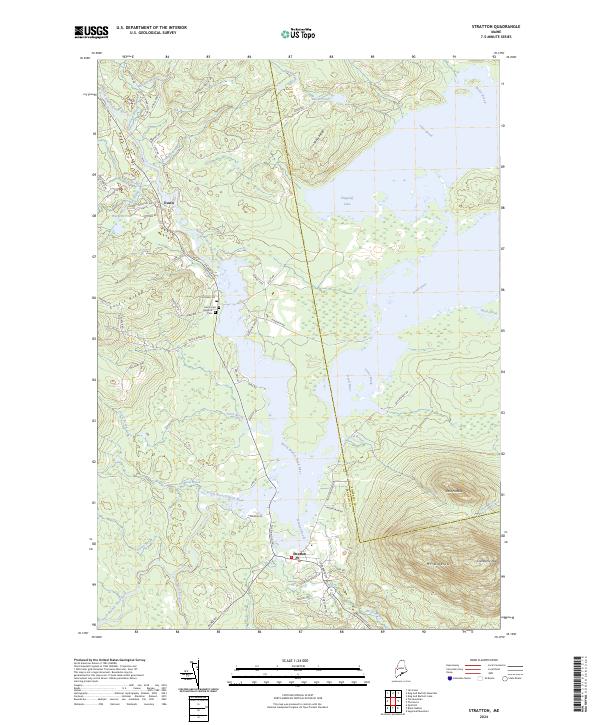
2024 Map of Stratton
USGS Topo · Published 2024About this map
Stratton and Eustis serve as the primary hubs in this remote Franklin County landscape, where the North Branch Dead River and South Branch Dead River converge. The geography is defined by the massive presence of Flagstaff Lake, which dominates the eastern half of the map and provides a stark contrast to the surrounding highlands. This area preserves a deep connection to early transit, specifically along the Arnold Trail, which follows the river valleys through the wilderness.
Find a feature on this map
69 named features on this map. Tap any name to fly to it.
Don’t see what you’re looking for? This feature index may not catch every label — zoom into the map to look around manually.
Map Details
Editions of this 2024 Stratton Map
This is the sole edition of this map. No revisions or reprints were ever made.
Other maps of this area

1928 · Chain Lakes
USGS Topo · 1:48,000

1928 · Spencer
USGS Topo · 1:48,000

1928 · Stratton
USGS Topo · 1:48,000

1932 · Stratton
USGS Topo · 1:62,500

1932 · Kennebago Lake
USGS Topo · 1:48,000

1932 · Spencer
USGS Topo · 1:62,500

1932 · Chain Lakes
USGS Topo · 1:62,500

1935 · Kennebago Lake
USGS Topo · 1:62,500

1935 · Chain Lakes
USGS Topo · 1:62,500

1936 · Kennebago Lake
USGS Topo · 1:62,500