
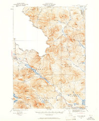
1932 Map of Chain Lakes
USGS Topo · Published 1961About this map
Arnold Trail follows the narrow corridors of the Chain of Ponds as it moves northwest toward the United States-Canada border. This rugged interior of Franklin and Somerset counties is defined by remote timber and sporting outposts such as Chain Lakes Camp, Caribou Camp, and Ben Dewitt Camp. The landscape reflects a specialized wilderness economy of the early 1930s, where small settlements like Upper Farm and the Morrell location stood along the edges of vast mountain tracts. Higher elevations are anchored by the Snow Mtn Fire Tower, providing a strategic overlook for this heavily forested region. Water dominates the lower elevations, from the broad reach of Jim Pond to the intricate network of brooks including Number One Brook and Stuart Brook that drain the slopes of Kibby Mountain and Caribou Mountain.
Find a feature on this map
112 named features on this map. Tap any name to fly to it.
Don’t see what you’re looking for? This feature index may not catch every label — zoom into the map to look around manually.
Map Details
Editions of this 1932 Chain Lakes Map
2 editions found
Other maps of this area

1923 · Attean
USGS Topo · 1:62,500

1925 · Attean
USGS Topo · 1:62,500

1928 · Chain Lakes
USGS Topo · 1:48,000

1928 · Skinner
USGS Topo · 1:48,000

1928 · Spencer
USGS Topo · 1:48,000

1928 · Stratton
USGS Topo · 1:48,000

1931 · Cupsuptic
USGS Topo · 1:48,000

1931 · Skinner
USGS Topo · 1:62,500

1932 · Stratton
USGS Topo · 1:62,500

1932 · Kennebago Lake
USGS Topo · 1:48,000