
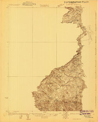
1923 Map of Attean
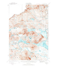
USGS Topo · Published 1965About this map
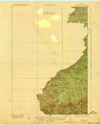
The Canadian Pacific railroad cuts through the heart of this North Woods territory, serving as a vital corridor between the small outposts of Holeb and Jackman Station. Surveyed in the early 1920s, the landscape is defined by its complex network of interconnected waterways and ridges, including the prominent Sally Mountain and Burnt Jacket Mountain. Along the shores of Little Big Wood Pond, local activity centers on locations like Foxs Camp and Dyerville, while Attean Landing marks a key point of access to the expansive Attean Pond.
Find a feature on this map
67 named features on this map. Tap any name to fly to it.
Don’t see what you’re looking for? This feature index may not catch every label — zoom into the map to look around manually.
Map Details
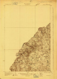
Editions of this 1923 Attean Map
2 editions found
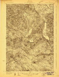
Other maps of this area

1922 · Long Pond
USGS Topo · 1:62,500

1924 · Long Pond
USGS Topo · 1:62,500

1925 · Pierce Pond
USGS Topo · 1:48,000

1925 · Attean
USGS Topo · 1:62,500
1927 · Sandy Bay
USGS Topo · 1:48,000

1927 · Pierce Pond
USGS Topo · 1:62,500

1928 · Chain Lakes
USGS Topo · 1:48,000
1928 · Skinner
USGS Topo · 1:48,000
1928 · Spencer
USGS Topo · 1:48,000
1930 · Sandy Bay
USGS Topo · 1:62,500