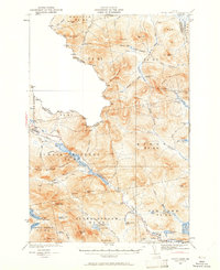
1932 Map of Chain Lakes
USGS Topo · Published 1961About this map
Arnold Trail follows the winding shoreline of the Chain of Ponds Lakes, tracing a historic corridor through the Maine wilderness along the United States Canada border. Surveyed in 1928 and 1932 by H.R. Kilmer and others, the landscape is defined by its logging and sporting heritage, evidenced by numerous outposts like Moose Mill Camp, Caribou Camp, and Ben Dewitt Camp.
Find a feature on this map
102 named features on this map. Tap any name to fly to it.
Don’t see what you’re looking for? This feature index may not catch every label — zoom into the map to look around manually.
Map Details
Editions of this 1932 Chain Lakes Map
2 editions found

Other maps of this area

1923 · Attean
USGS Topo · 1:62,500

1925 · Attean
USGS Topo · 1:62,500

1928 · Chain Lakes
USGS Topo · 1:48,000

1928 · Skinner
USGS Topo · 1:48,000

1928 · Spencer
USGS Topo · 1:48,000

1928 · Stratton
USGS Topo · 1:48,000

1931 · Cupsuptic
USGS Topo · 1:48,000

1931 · Skinner
USGS Topo · 1:62,500

1932 · Stratton
USGS Topo · 1:62,500

1932 · Kennebago Lake
USGS Topo · 1:48,000