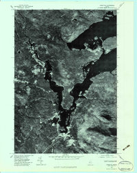
1977 Map of Stratton
USGS Topo · Published 1983About this map
Stratton and Eustis are the primary settlements in this orthophotograph, situated within a landscape defined by the expansive waters of Flagstaff Lake. The imagery, prepared from aerial photography taken in late October 1977, reveals the complex shoreline and the dense forest cover of the Maine woods during the late twentieth century. In the southern portion of the quadrangle, the terrain rises toward Cranberry Peak and East Nubble, while the hydrologic pattern is shaped by South Branch Nash Stream and Lutton Brook. This orthophotoquad provides a direct visual record of land use and timber management patterns as they existed before 1980s development, showing the clear distinction between the clustered buildings of the villages and the surrounding wilderness and water.
Find a feature on this map
7 named features on this map. Tap any name to fly to it.
Don’t see what you’re looking for? This feature index may not catch every label — zoom into the map to look around manually.
Map Details
Editions of this 1977 Stratton Map
This is the sole edition of this map. No revisions or reprints were ever made.
Other maps of this area

1928 · Chain Lakes
USGS Topo · 1:48,000

1928 · Spencer
USGS Topo · 1:48,000

1928 · Stratton
USGS Topo · 1:48,000

1932 · Stratton
USGS Topo · 1:62,500

1932 · Kennebago Lake
USGS Topo · 1:48,000

1932 · Spencer
USGS Topo · 1:62,500

1932 · Chain Lakes
USGS Topo · 1:62,500

1935 · Kennebago Lake
USGS Topo · 1:62,500

1935 · Chain Lakes
USGS Topo · 1:62,500

1936 · Kennebago Lake
USGS Topo · 1:62,500