Old Maps of Flagstaff Township, Maine
Explore 42 old maps of Flagstaff Township, spanning from 1928 to today. These high-resolution historic maps reveal how streets, neighborhoods, landmarks, and natural features evolved over time — perfect for genealogy, metal detecting, research, and local history exploration.
What you can do with these maps:
- See how Flagstaff Township changed over time: Compare historical maps to modern-day views to trace roads, homesites, rail lines & more.
- View detailed metadata: Each map includes creators, publishers, year, scale, and archive source.
- Overlay maps with satellite & LiDAR: Visualize the past alongside modern tools to explore terrain & human change.
- Trusted historical sources: Maps sourced from the USGS, Library of Congress, and other archives.
- Access maps your way: View online, download high-res files, or order prints for personal or research use.
Start exploring old maps of Flagstaff Township to uncover forgotten places, hidden landmarks, and the deep history beneath your feet.
Flagstaff Township, ME maps
(42)- 1928 Map of Spencer
 1928 Spencer1928 Print · USGSNorthern Maine's remote logging and sporting country is captured here during the late 1920s. You can trace early wilderness outposts like Gerard (PO) Spencer Lake Camps and Kibby Kamp near Spencer Lake.2 unique versions available
 - 1928 Map of Stratton
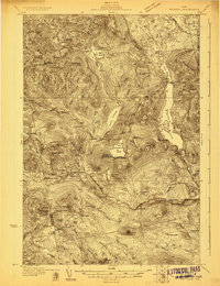
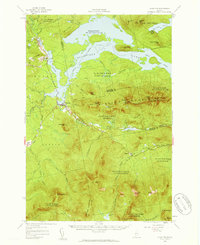
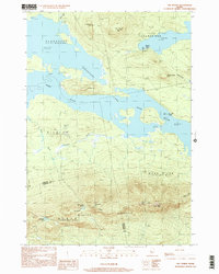
 1928 Stratton1928 Print · USGSThe village of Flagstaff and the Dead River valley appear here in the late 1920s, just decades before the landscape was transformed by damming. You can trace the original valley settlements and landmarks like Morgan Farm, Cathedral Pines, and Morgan Camp.3 unique versions available
 - 1932 Map of Stratton
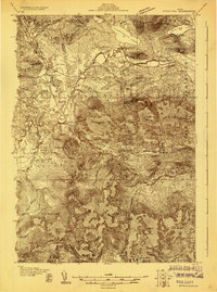
 1932 Stratton1932 Print · USGSThe northern Maine woods in the late twenties and early thirties are captured here during a time of river-driven logging and remote plantation life. Local historians can trace the foundations of Eustis, the original layout of Flagstaff Pond, and rural schoolhouses like Browns Sch.3 unique versions available
 - 1932 Map of Spencer
 1932 Spencer1932 Print · USGSSomerset County’s wilderness is detailed here in the late twenties, showing a landscape defined by logging camps and remote sporting outposts. Researchers can trace the footprint of the Augusta Lumber Co Camp or locate the Spencer Lake Camps Gerard P O and Kibby Kamp.4 unique versions available
 - 1949 Map of Jackman
 1949 Jackman1949 Print · USGSThe Quebec and Maine borderlands are shown in great detail during the late 1940s, highlighting the industrial and natural geography of the region. Trace old rail lines like the Canadian Pacific and locate settlements from Sherbrooke to Scotstown.2 unique versions available
 - 1956 Map of Stratton, 1959 Print
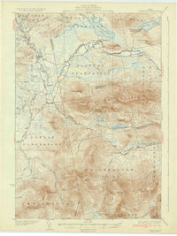
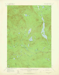
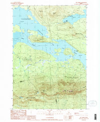
 1956 Stratton1959 Print · USGSThe Franklin County highlands in the mid-1950s show a landscape defined by the expansion of Flagstaff Lake and the timber economy. Researchers can trace the Appalachian Trail over Bigelow Mountain or locate the Flagstaff Memorial Church and the Coplin School.3 unique versions available
 - 1958 Map of Spencer Lake, 1960 Print
 1958 Spencer Lake1960 Print · USGSSomerset County’s remote wilderness is documented here in the late fifties, showing a landscape shaped by the timber and sporting industries. Researchers can locate specific seasonal outposts like Hobbstown Depot Camp, Kibby Kamp, and the Spencer Dam.3 unique versions available
 - 1963 Map of Jackman
 1963 Jackman1963 Print · USGSThe international borderlands of Maine and Quebec come alive in the mid-twentieth century, showing a landscape of timber towns and rail connections. Genealogists and historians can trace the paths of the Canadian Pacific Railway through Jackman or locate families in Sherbrooke and Megantic.
 - 1966 Map of Sherbrooke
 1966 Sherbrooke1966 Print · USGSThe borderlands of Quebec and Maine come alive in the mid-1960s, documenting the industrial towns and deep woods of the Northeast. Genealogists can trace family lines through Sherbrooke and Coaticook, or locate remote logging outposts along the Moose River and Flagstaff Lake.
 - 1976 Map of Sherbrooke
 1976 Sherbrooke1976 Print · USGSThe northern Maine woods and Quebec’s Eastern Townships meet in this mid-century survey of the rugged international borderlands. Genealogists and historians can trace rail-and-river connections through Thetford Mines, follow the Dead River to Flagstaff Lake, or locate small border crossings at Stanhope and Beecher Falls.2 unique versions available
 - 1977 Map of King And Bartlett Lake, 1983 Print
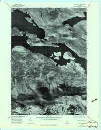
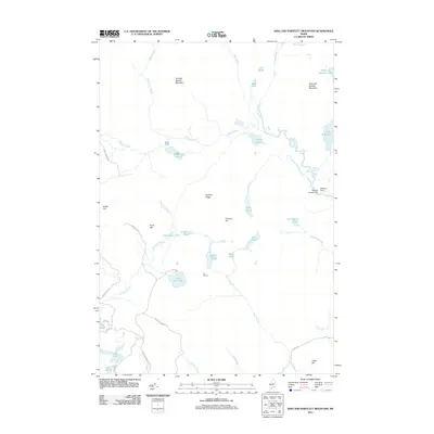
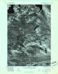 1977 King And Bartlett Lake1983 Print · USGSSomerset County’s remote timberlands and waterways are captured in the late seventies through high-resolution aerial photography. Researchers can trace the winding paths of Spencer Stream and Little Spencer Stream or identify the shoreline of King And Bartlett Lake.
 - 1977 Map of King and Bartlett Mountain, 1983 Print
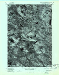 1977 King and Bartlett Mountain1983 Print · USGSSomerset County’s deep woods and mountain peaks are captured in this late 1970s aerial survey of the Maine wilderness. Outdoorsmen and historians can trace the natural drainages of Kibby Stream and Spencer Stream or locate King and Bartlett Lake.
 - 1977 Map of Stratton, 1983 Print
 1977 Stratton1983 Print · USGSThe villages of Stratton and Eustis are shown in this late-seventies aerial perspective of the Maine woods. Researchers can trace the shoreline of Flagstaff Lake and identify topographic landmarks like Cranberry Peak.
 - 1977 Map of The Horns, 1983 Print
 1977 The Horns1983 Print · USGSSomerset County, Maine, is captured here in the late 1970s, showcasing the massive expanse of Flagstaff Lake and the high peaks of the Bigelow Range. Researchers can trace the shoreline of the Dead River valley or locate landmarks like The Horns and Spring Lake.
 - 1986 Map of Flagstaff Lake
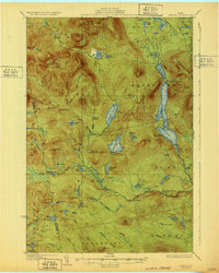
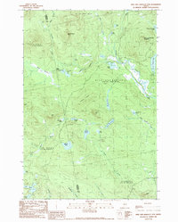
 1986 Flagstaff Lake1986 Print · USGSThe Maine North Woods and the Dead River valley are captured here in the mid-1980s, an era of established hydroelectric lakes and outdoor recreation. Genealogists and researchers can trace the vicinity of Kennebago Settlement, Langtown Mill, and the villages of Stratton and Eustis.
 - 1989 Map of Kind and Bartlett Mtn.
 1989 Kind and Bartlett Mtn.1989 Print · USGSSomerset and Franklin counties meet in this 1980s Maine wilderness, where timberlands and high-country waters define the terrain. Trace remote backcountry sites like Kibby Kamp or follow the shoreline of King and Bartlett Lake and Joe Pokum Pond.2 unique versions available
 - 1989 Map of Stratton
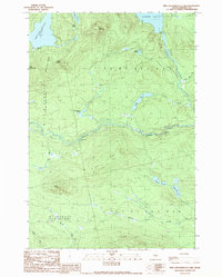
 1989 Stratton1989 Print · USGSThe northern Maine woods meet the expansive waters of Flagstaff Lake in the late 1980s, documenting a landscape shaped by the Dead River. Researchers can locate family sites near the village of Stratton, the small Cem near the river, and the high summits of Bigelow Mountain.
 - 1989 Map of Kind And Bartlett Lake
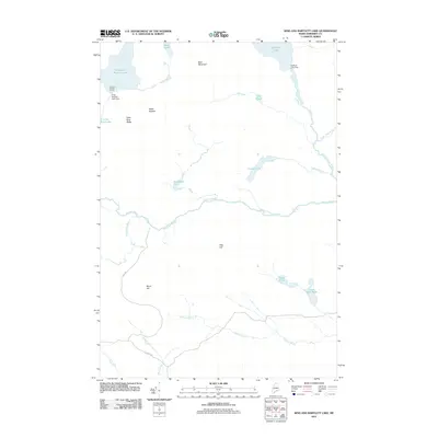
 1989 Kind And Bartlett Lake1989 Print · USGSSomerset County's north woods appear here in the late eighties, a landscape of remote townships and deep timberlands. Outdoor enthusiasts and local historians can map the waterways between Spencer Lake and King and Bartlett Lake, including Gore Rapids and Spencer Gut.2 unique versions available
 - 1989 Map of The Horns
 1989 The Horns1989 Print · USGSHigh peaks and flooded valleys define the Somerset County landscape in the late eighties. Hikers and historians can trace the Appalachian National Scenic Trail over The Horns and locate sites like the Bigelow Lookout Tower and Hurricane Island.
 - 1994 Map of Flagstaff Lake
 1994 Flagstaff Lake1994 Print · USGSThe Maine wilderness and the Quebec border come alive in this mid-nineties survey of the Dead River country. Researchers can trace the Appalachian Trail over Bigelow Mountain and locate remote sites like Kennebago Settlement.
 - 1997 Map of Stratton, 2000 Print
 1997 Stratton2000 Print · USGSThe northern Maine woods near the close of the century are defined here by the great expanse of Flagstaff Lake. Local historians can trace the settlement footprints of Stratton and Eustis or locate remote camps near Jim Pond and Cranberry Peak.
 - 1997 Map of The Horns, 2000 Print
 1997 The Horns2000 Print · USGSHigh peaks and deep waters define this corner of Somerset County in the late nineties. Hikers and historians can trace the Appalachian National Scenic Trail across The Horns and Avery Peak overlooking the expansive Flagstaff Lake.
 - 2011 Map of King And Bartlett Mountain, 2011 Print
 2011 King And Bartlett Mountain2011 Print · USGSCovers Flagstaff Township, including Haynestown Township, King & Bartlett Township, and other nearby areas
 - 2011 Map of Stratton, 2011 Print
 2011 Stratton2011 Print · USGSCovers Flagstaff Township, including Eustis, Coplin Plantation, and other nearby areas
 - 2011 Map of King And Bartlett Lake, 2011 Print
 2011 King And Bartlett Lake2011 Print · USGSCovers Flagstaff Township, including T3 R5 BKP WKR, Spring Lake Township, and other nearby areas
Showing maps 1-25 of 42
Top cities near Flagstaff Township
- Kingfield historical maps
- Carrabassett Valley historical maps
- Eustis historical maps
- Dallas Plantation historical maps
- Coplin Plantation historical maps
- Wyman Township historical maps
See more
Frequently asked questions
- What are the different types of historical maps available for Flagstaff Township?
- What is the oldest map of Flagstaff Township?
- Where can I purchase historical maps of Flagstaff Township for my home or office?
- Where can I download high-res historical maps of Flagstaff Township?
- Are there historical topographic maps available for Flagstaff Township?
- Is there historical aerial imagery available for Flagstaff Township?
- Where are historical maps of Flagstaff Township sourced from?