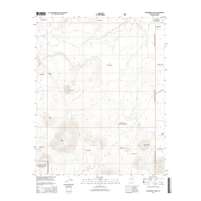
2014 Map of Strawberry Crater
USGS Topo · Published 2014About this map
The cinder cones and basaltic fields of Coconino County dominate this 2014 survey, highlighting the volcanic legacy of the San Francisco Volcanic Field. Centered on Strawberry Crater, the landscape transitions from high mesas to deep basins. The northern boundary touches the corner of Wupatki National Monument, while the southwestern quadrant encompasses portions of Sunset Crater Volcano National Monument. Geologic features such as the Kana-a Lava Flow and Black Bottom Crater are clearly defined alongside drainage patterns like Deadman Wash. This area of the Coconino National Forest reflects a wilderness managed for both its natural history and preservation, with Woodhouse Mesa and Deadman Mesa rising as prominent landmarks above the surrounding plains. The presence of the Sunset Crater-Wupatki Loop provides the primary transit artery through this geological study area.
Find a feature on this map
24 named features on this map. Tap any name to fly to it.
Don’t see what you’re looking for? This feature index may not catch every label — zoom into the map to look around manually.
Map Details
Editions of this 2014 Strawberry Crater Map
This is the sole edition of this map. No revisions or reprints were ever made.
Other maps of this area

1886 · San Francisco Mtns
USGS Topo · 1:250,000

1891 · San Francisco Mtns
USGS Topo · 1:250,000

1894 · San Francisco Mtns
USGS Topo · 1:250,000

1899 · San Francisco Mtns
USGS Topo · 1:250,000

1908 · Flagstaff
USGS Topo · 1:125,000

1912 · Flagstaff
USGS Topo · 1:125,000

1947 · Flagstaff
USGS Topo · 1:250,000

1954 · Flagstaff
USGS Topo · 1:250,000

1958 · Flagstaff
USGS Topo · 1:250,000

1960 · Flagstaff
USGS Topo · 1:250,000