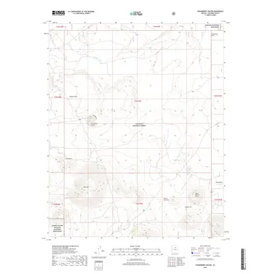
2018 Map of Strawberry Crater
USGS Topo · Published 2018About this map
Strawberry Crater and the surrounding volcanic landscape dominate this high-desert terrain within the Coconino National Forest. The geography is defined by cinder cones and ancient eruptions, including the prominent Black Mtn and the distinctively circular Black Bottom Crater to the southeast. To the north, the drainage of Deadman Wash cuts across the arid plains near Deadman Mesa, while the southern reaches of the map touch upon the preserved volcanic features of the Sunset Crater Volcano National Monument.
Find a feature on this map
23 named features on this map. Tap any name to fly to it.
Don’t see what you’re looking for? This feature index may not catch every label — zoom into the map to look around manually.
Map Details
Editions of this 2018 Strawberry Crater Map
This is the sole edition of this map. No revisions or reprints were ever made.
Other maps of this area

1886 · San Francisco Mtns
USGS Topo · 1:250,000

1891 · San Francisco Mtns
USGS Topo · 1:250,000

1894 · San Francisco Mtns
USGS Topo · 1:250,000

1899 · San Francisco Mtns
USGS Topo · 1:250,000

1908 · Flagstaff
USGS Topo · 1:125,000

1912 · Flagstaff
USGS Topo · 1:125,000

1947 · Flagstaff
USGS Topo · 1:250,000

1954 · Flagstaff
USGS Topo · 1:250,000

1958 · Flagstaff
USGS Topo · 1:250,000

1960 · Flagstaff
USGS Topo · 1:250,000