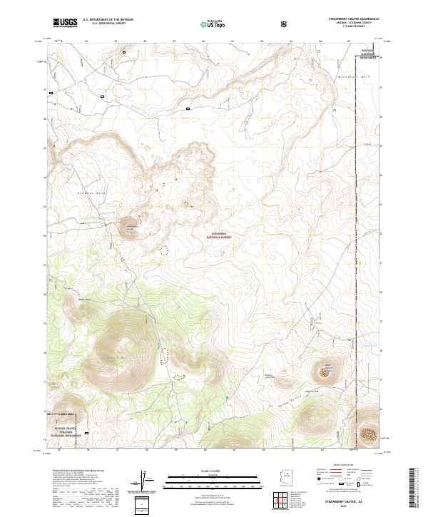
2021 Map of Strawberry Crater
USGS Topo · Published 2021About this map
Coconino National Forest defines this high-desert landscape, dominated by significant volcanic features and the protected lands of northern Arizona. The namesake Strawberry Crater sits at the center of the sheet, accessed via the Strawberry Trl, while the dramatic Kana-a Lava Flow stretches across the southeastern quadrant toward Kanaa Valley. The map details a transition between mesa-top geography, such as Woodhouse Mesa and Deadman Mesa, and the lower relief of Haywire Flat. Drainage patterns like Deadman Wash and Kanaa Wash carve through the terrain, illustrating the hydrologic flow toward the borders of Wupatki National Monument. This survey serves as a vital record of the geological and administrative boundaries near the Sunset Crater Volcano National Monument as they existed in the early twenty-first century.
Find a feature on this map
25 named features on this map. Tap any name to fly to it.
Don’t see what you’re looking for? This feature index may not catch every label — zoom into the map to look around manually.
Map Details
Editions of this 2021 Strawberry Crater Map
This is the sole edition of this map. No revisions or reprints were ever made.
Other maps of this area

1886 · San Francisco Mtns
USGS Topo · 1:250,000

1891 · San Francisco Mtns
USGS Topo · 1:250,000

1894 · San Francisco Mtns
USGS Topo · 1:250,000

1899 · San Francisco Mtns
USGS Topo · 1:250,000

1908 · Flagstaff
USGS Topo · 1:125,000

1912 · Flagstaff
USGS Topo · 1:125,000

1947 · Flagstaff
USGS Topo · 1:250,000

1954 · Flagstaff
USGS Topo · 1:250,000

1958 · Flagstaff
USGS Topo · 1:250,000

1960 · Flagstaff
USGS Topo · 1:250,000