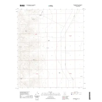
2020 Map of Strawberry Peak
USGS Topo · Published 2020About this map
The eastern flanks of the San Andres Mountains dominate this 2020 topographic landscape, where steep elevation changes give way to the broad flats of the Tularosa Basin. This portion of Sierra County is characterized by significant topographic relief, with the high ridges of the mountains plummeting toward the eastern alkaline plains. Natural water sources are extremely limited in this desert environment, making the presence of Eagle Nest Spring a critical landmark for the area's hydrology. The map illustrates a transition from the rugged mountain slopes to the vast basin floor, a terrain pattern that has historically dictated animal movement and human navigation through this arid region of New Mexico.
Find a feature on this map
1 named feature on this map. Tap any name to fly to it.
Don’t see what you’re looking for? This feature index may not catch every label — zoom into the map to look around manually.
Map Details
Editions of this 2020 Strawberry Peak Map
This is the sole edition of this map. No revisions or reprints were ever made.
Other maps of this area

1916 · Tonuco
USGS Topo · 1:125,000

1916 · Salinas Peak
USGS Topo · 1:125,000

1916 · Tularosa
USGS Topo · 1:125,000

1916 · Point Of Sands
USGS Topo · 1:125,000

1932 · Tonuco
USGS Topo · 1:125,000

1947 · Point Of Sands 2
USGS Topo · 1:62,500

1948 · Kaylor Mountain
USGS Topo · 1:62,500

1948 · Black Top Mountain
USGS Topo · 1:62,500

1948 · Lumley Lake
USGS Topo · 1:62,500

1954 · Tularosa
USGS Topo · 1:250,000