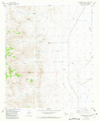
1981 Map of Strawberry Peak
USGS Topo · Published 1981About this map
White Sands Missile Range dominates this 1981 terrain study, revealing the high-desert geography of Sierra County. The landscape is defined by the sharp rise of Gunsight Peak and Black Top Mountain in the west, giving way to the vast expanse of the Alkali Flat to the east. This transition from mountainous canyons to desert basins highlights the isolation of the area during the Cold War era of military testing. Scattered human presence is limited to industrial and pastoral markers, including several Prospect sites and remote water sources like Bat Ranch Spring, Henderson Well, and Moore Well. A solitary Radio Tower stands on a ridge above Cottonwood Canyon, while a rugged Jeep Trail provides the primary access route across the eastern flats.
Find a feature on this map
21 named features on this map. Tap any name to fly to it.
Don’t see what you’re looking for? This feature index may not catch every label — zoom into the map to look around manually.
Map Details
Editions of this 1981 Strawberry Peak Map
This is the sole edition of this map. No revisions or reprints were ever made.
Other maps of this area

1916 · Tonuco
USGS Topo · 1:125,000

1916 · Salinas Peak
USGS Topo · 1:125,000

1916 · Tularosa
USGS Topo · 1:125,000

1916 · Point Of Sands
USGS Topo · 1:125,000

1932 · Tonuco
USGS Topo · 1:125,000

1947 · Point Of Sands 2
USGS Topo · 1:62,500

1948 · Kaylor Mountain
USGS Topo · 1:62,500

1948 · Black Top Mountain
USGS Topo · 1:62,500

1948 · Lumley Lake
USGS Topo · 1:62,500

1954 · Tularosa
USGS Topo · 1:250,000