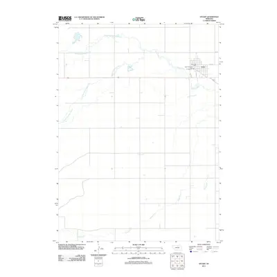
2011 Map of Stuart
USGS Topo · Published 2011About this map
Stuart serves as the central hub of this Holt County landscape, situated where the high plains meet the intricate drainage system of the Elkhorn River. The town's layout is defined by its core along Main St and E 4th St, featuring local landmarks like the Stuart Post Office and the Stuart Municipal Park Campground. The surrounding terrain is heavily influenced by the confluence of several vital waterways, including the North Branch Elkhorn River and the South Fork Elkhorn River, which meander through the prairie north and west of the settlement. To the south, the channel of Keegan Creek cuts through the countryside, illustrating the natural water network that has supported agricultural life in this region of Nebraska for generations. This 2011 survey captures the town's footprint and its immediate relationship to the riverbanks before the landscape shifts into the open ranch land characteristic of northern Nebraska.
Find a feature on this map
11 named features on this map. Tap any name to fly to it.
Don’t see what you’re looking for? This feature index may not catch every label — zoom into the map to look around manually.
Map Details
Editions of this 2011 Stuart Map
This is the sole edition of this map. No revisions or reprints were ever made.
Other maps of this area

1954 · Stuart
USGS Topo · 1:24,000

1954 · Stuart SE
USGS Topo · 1:24,000

1954 · Stuart NW
USGS Topo · 1:24,000

1954 · Newport NE
USGS Topo · 1:24,000

1954 · Newport
USGS Topo · 1:24,000

1954 · Stuart NE
USGS Topo · 1:24,000

1955 · O'Neill
USGS Topo · 1:250,000

1959 · O'Neill
USGS Topo · 1:250,000

1969 · O'Neill
USGS Topo · 1:250,000

1982 · Dora Lake
USGS Topo · 1:24,000