
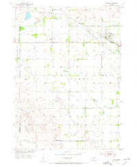
1954 Map of Stuart
USGS Topo · Published 1955About this map
Stuart serves as the primary hub of activity in this 1954 survey of north-central Nebraska, situated where the Chicago and North Western railroad parallels the winding course of the North Fork Elkhorn River. The town's grid is dense with detail, reflecting its role as a key transit point for the region's agricultural output. Beyond the settlement, the landscape is defined by the convergence of several waterways, including the South Fork Elkhorn River and Keegan Creek, which drain the prairie terrain. A series of rural schoolhouses, such as School No 136, School No 58, and School No 70, are distributed across the township, providing a clear record of the district-based education system that supported the farming and ranching families of Stuart township in the mid-20th century. The western edge of the map identifies the boundary between Rock Co Holt Co.
Find a feature on this map
11 named features on this map. Tap any name to fly to it.
Don’t see what you’re looking for? This feature index may not catch every label — zoom into the map to look around manually.
Map Details
Editions of this 1954 Stuart Map
2 editions found
Other maps of this area

1954 · Stuart SE
USGS Topo · 1:24,000

1954 · Stuart NW
USGS Topo · 1:24,000

1954 · Newport NE
USGS Topo · 1:24,000

1954 · Newport
USGS Topo · 1:24,000

1954 · Stuart NE
USGS Topo · 1:24,000

1955 · O'Neill
USGS Topo · 1:250,000

1959 · O'Neill
USGS Topo · 1:250,000

1969 · O'Neill
USGS Topo · 1:250,000

1982 · Dora Lake
USGS Topo · 1:24,000
1982 · Pony Lake
USGS Topo · 1:24,000