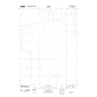
2011 Map of Stuart NW
USGS Topo · Published 2011About this map
Agricultural operations and expansive ranching lands define this rural landscape in Holt County during the early 21st century. The map highlights specific family-owned properties such as the Muesch Ranch in the northeast and the Shald Ranch further south, illustrating the enduring nature of large-scale landholdings in this part of Nebraska. The terrain is marked by the presence of vital waterways, including Beaver Creek and Ash Creek, which provide essential drainage and water sources for the surrounding pastures. The geometric layout of local infrastructure is represented by routes like 887th Rd, showing the systematic section-line road network that facilitates movement across this open country.
Find a feature on this map
5 named features on this map. Tap any name to fly to it.
Don’t see what you’re looking for? This feature index may not catch every label — zoom into the map to look around manually.
Map Details
Editions of this 2011 Stuart NW Map
This is the sole edition of this map. No revisions or reprints were ever made.
Other maps of this area

1950 · Mariaville
USGS Topo · 1:24,000

1951 · Dustin
USGS Topo · 1:24,000

1951 · Naper SW
USGS Topo · 1:24,000

1954 · Stuart
USGS Topo · 1:24,000

1954 · Stuart SE
USGS Topo · 1:24,000

1954 · Stuart NW
USGS Topo · 1:24,000

1954 · Newport NE
USGS Topo · 1:24,000

1954 · Newport
USGS Topo · 1:24,000

1954 · Stuart NE
USGS Topo · 1:24,000

1955 · O'Neill
USGS Topo · 1:250,000