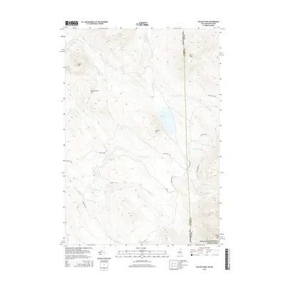
2015 Map of Success Pond
USGS Topo · Published 2015About this map
Success Pond sits at the heart of this high-elevation landscape along the border of New Hampshire and Maine. In this 2015 survey, the terrain is defined by a series of prominent peaks and ridgelines, including Chickwolnepy Mtn to the west and the soaring Goose Eye Mtn in the southeast. The drainage system is complex, with Chickwolnepy Stream and Stearns Brook carving through the valleys. The map documents the route of the Appalachian National Scenic Trail as it crosses the state line, providing a record of the trail's modern alignment through this undeveloped region. A network of primitive logging roads such as Success Pond Rd and Mary Grande Rd provides the primary access to the interior, reflecting the area's continued use for timber and recreation rather than permanent settlement.
Find a feature on this map
27 named features on this map. Tap any name to fly to it.
Don’t see what you’re looking for? This feature index may not catch every label — zoom into the map to look around manually.
Map Details
Editions of this 2015 Success Pond Map
This is the sole edition of this map. No revisions or reprints were ever made.
Other maps of this area

1893 · Gorham
USGS Topo · 1:62,500

1896 · Gorham
USGS Topo · 1:62,500

1914 · Bethel
USGS Topo · 1:62,500

1930 · Milan
USGS Topo · 1:62,500

1933 · Milan
USGS Topo · 1:62,500

1934 · Milan
USGS Topo · 1:62,500

1937 · Gorham
USGS Topo · 1:48,000

1940 · Bethel
USGS Topo · 1:62,500

1941 · Bethel
USGS Topo · 1:62,500

1942 · Gorham
USGS Topo · 1:62,500