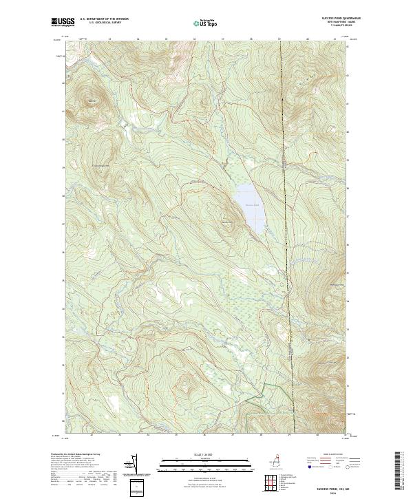
2024 Map of Success Pond
USGS Topo · Published 2024About this map
Success Pond sits at the center of this high-elevation landscape along the border of Coos County, New Hampshire, and Oxford County, Maine. The terrain is defined by the sharp elevations of the Mahoosuc Range, including Mahoosuc Mtn and the prominent Chickwolnepy Mtn to the west. This modern topographic study reveals a network of logging and access roads such as Success Pond Rd and Mary Grande Rd that cut through the dense drainage basins of Chickwolnepy Stream and Stearns Brook. The southern portion of the map is notable for the passage of the Appalachian National Scenic Trail, which winds through the peaks near the state line. Hikers and surveyors can trace the precise route of the Notch Trl and Goose Eye Trl as they interface with the Height of Land Rd, marking a significant corridor for recreation and wilderness management in the North Country.
Find a feature on this map
30 named features on this map. Tap any name to fly to it.
Don’t see what you’re looking for? This feature index may not catch every label — zoom into the map to look around manually.
Map Details
Editions of this 2024 Success Pond Map
This is the sole edition of this map. No revisions or reprints were ever made.
Other maps of this area

1893 · Gorham
USGS Topo · 1:62,500

1896 · Gorham
USGS Topo · 1:62,500

1914 · Bethel
USGS Topo · 1:62,500

1930 · Milan
USGS Topo · 1:62,500

1933 · Milan
USGS Topo · 1:62,500

1934 · Milan
USGS Topo · 1:62,500

1937 · Gorham
USGS Topo · 1:48,000

1940 · Bethel
USGS Topo · 1:62,500

1941 · Bethel
USGS Topo · 1:62,500

1942 · Gorham
USGS Topo · 1:62,500