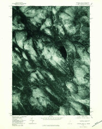
1976 Map of Success Pond
USGS Topo · Published 1983About this map
Success Pond sits at the heart of this orthophotoquad, which captures the heavily forested New Hampshire-Maine borderlands during the mid-1970s. This aerial perspective, prepared by the Geological Survey, offers a distinct view of the land's texture, where the dense timber stands of Coos County are interrupted only by the deep waters of the pond and the peaks of Bald Mountain. The map reveals a complex network of drainage systems, including the North Branch and South Branch of the local waterways, along with the narrow paths of Silver Stream and Stearns Brook.
Find a feature on this map
7 named features on this map. Tap any name to fly to it.
Don’t see what you’re looking for? This feature index may not catch every label — zoom into the map to look around manually.
Map Details
Editions of this 1976 Success Pond Map
This is the sole edition of this map. No revisions or reprints were ever made.
Other maps of this area

1893 · Gorham
USGS Topo · 1:62,500

1896 · Gorham
USGS Topo · 1:62,500

1914 · Bethel
USGS Topo · 1:62,500

1930 · Milan
USGS Topo · 1:62,500

1933 · Milan
USGS Topo · 1:62,500

1934 · Milan
USGS Topo · 1:62,500

1937 · Gorham
USGS Topo · 1:48,000

1940 · Bethel
USGS Topo · 1:62,500

1941 · Bethel
USGS Topo · 1:62,500

1942 · Gorham
USGS Topo · 1:62,500